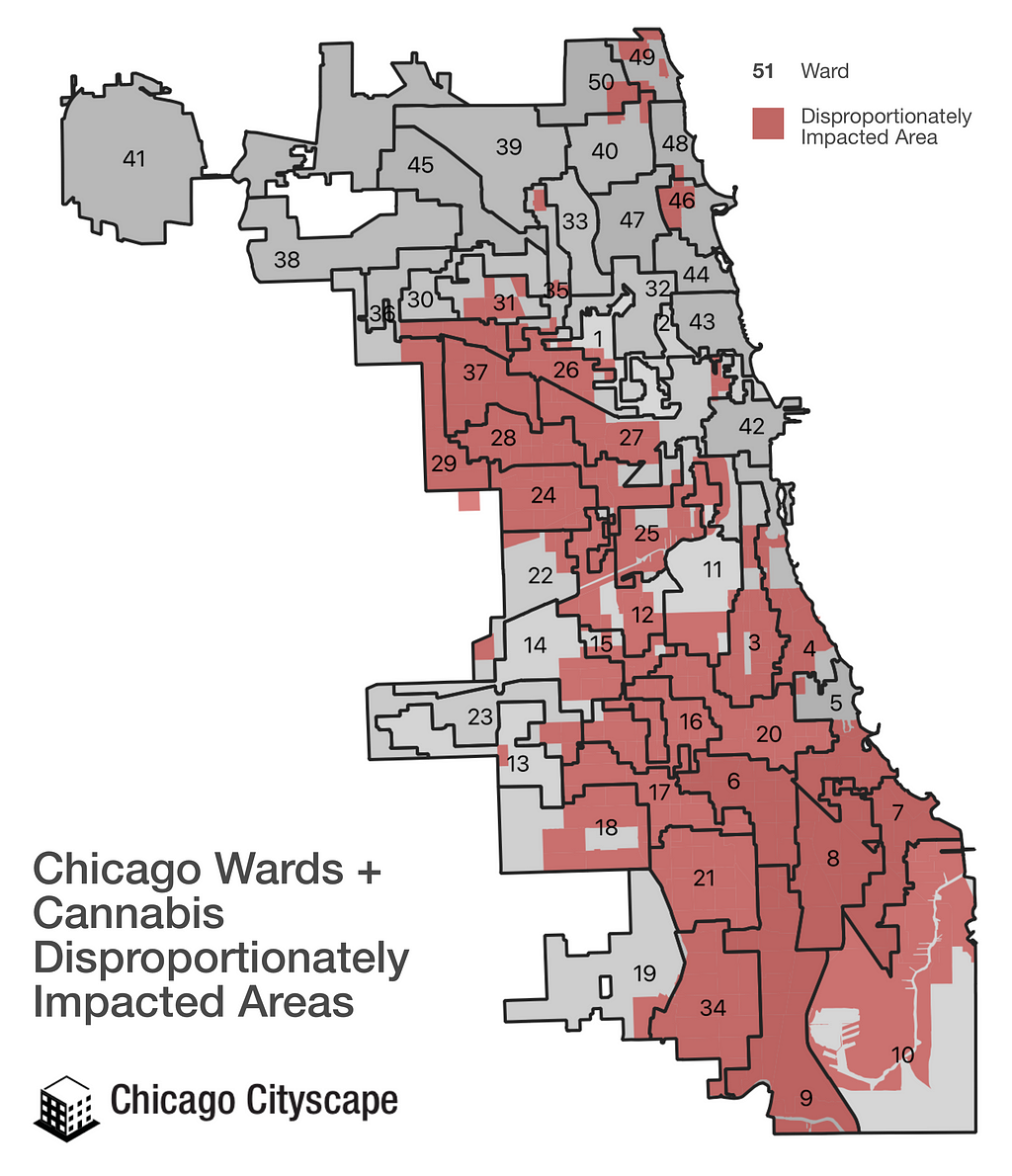
The Illinois law that legalizes recreational marijuana cultivation and sales establishes “disproportionately impacted areas” (DIA). These are places across the state where there has been a high rate of people being incarcerated for violating anti-marijuana laws and have high poverty or unemployment. The Illinois Department of Commerce and Economic Opportunity (DCEO) published the DIAs this month.
In the process to apply for a dispensary license, people can earn extra points in the review of their applications for being a “Social Equity Applicant” (see the Cannabis Regulation & Tax Act and the application instructions). One of the qualifying criteria is that the applicant has lived in a DIA for a minimum period of time. Another is that at least half of the applicant’s future 10+ person staff reside in DIAs.
I compared the DIAs — which use Census tract boundaries — to the Chicago ward boundaries to help readers and customers understand where these areas are. Additionally, since the Neighborhood Opportunity Fund program rules were tweaked to allow the City of Chicago to offer grants to cannabis business establishments, I’ve created a map showing where those areas overlap.
Map shows the 50 Chicago wards and how they overlap with State of Illinois-designated Disproportionately Impacted Areas.
DIAs + Chicago Wards
The following ten Chicago wards are entirely overlapping with Disproportionately Impacted Areas (each link opens a map of the ward):
The 42nd Ward is functionally one of the six wards with no Disproportionately Impacted Areas.
An additional 13 wards are majority in a DIA: 3rd, 4th, 5th, 10th, 12th, 15th, 16th, 18th, 25th, 26th, 27th, 28th, and the 29th Wards.
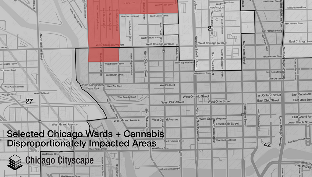
Six wards have no overlap with DIAs (30th, 33rd, 42nd, 43rd, 44th, and the 47th Wards). The 42nd Ward functionally has no DIAs even though it overlaps a tiny bit with a DIA (see map).
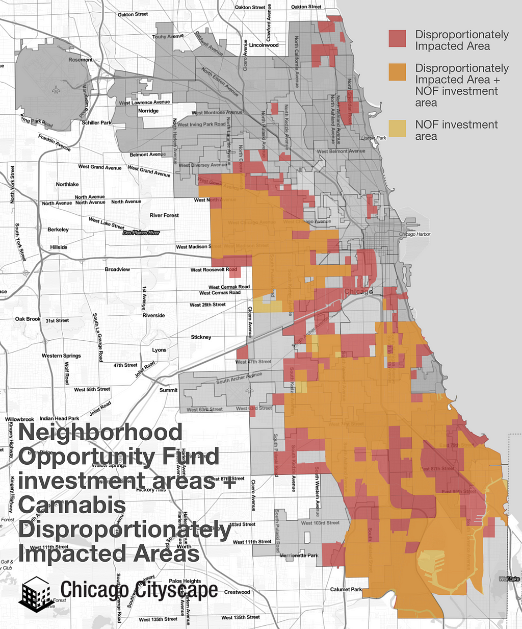
DIAs + Neighborhood Opportunity Fund areas
The Neighborhood Opportunity Fund (NOF) is a grant program for small businesses on the South and West Sides in the NOF investment areas. NOF is funded by payments made according to the Neighborhood Opportunity Bonus (NOB) program, which allows developers to purchase additional building density in the downtown area.
There is a lot of overlap between the Disproportionately Impacted Areas and the Neighborhood Opportunity Fund investment areas.
Eighty percent of the NOB proceeds go to the NOF; ten percent goes to a local improvements fund, which can also be in kind (when approved by city planners, the developer pays their own contractor for an improvement to a street, park, or library); ten percent goes to stabilize or renovate landmarked buildings.
Yesterday, Mayor Lightfoot announced changes to the NOF grant program, which include being able to give grants to potential cannabis businesses.
Another important change is funding startup costs “like appraisals, environmental surveys and architectural services”. Previously, the NOF program wouldn’t grant any money upfront; the small business owner had to raise money on their own and get reimbursed by NOF later.
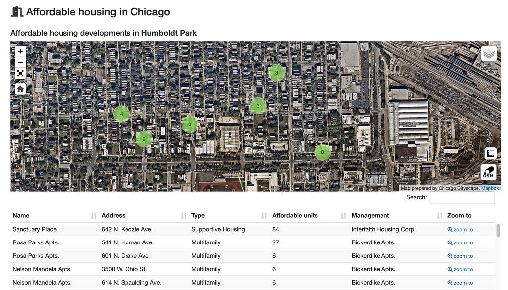
The City of Chicago supports the construction and maintenance of affordable housing through direct funding, financing, and regulations — that’s “Affordable housing” with a capital “A” because there are rules that define what kind of rental and sale prices constitute affordable. The Chicago Department of Housing tracks the location of these affordable dwelling units and recently enhanced their version of the data on the City’s data portal.
We’ve also integrated that improved dataset of affordable apartment buildings across Chicago Cityscape.
Look up the Humboldt Park community area, for example, to find the location of 36 affordable housing developments that the Chicago Department of Housing tracks with a total of 846 affordable dwelling units.
Recently, the City added the location of residential units that were constructed by property owners to comply with the Affordable Requirements Ordinance, or ARO, which added about 200 more buildings to the dataset.
The ARO, generally, requires that builders set aside 10 percent of the new or added units as Affordable for 30 years if the builder receives a zoning change in order to build or add 10 or more units.
The location of ARO and units funded through other means (like the Low Income Housing Trust Fund or TIF) is important to track compliance over the duration of the funding for those residences, and to help residents find known affordable housing. Naturally occurring affordable housing’s location isn’t tracked by any local organization officially, except when it’s disappearing.
How to find affordable housing on Chicago Cityscape
There are two ways to use Chicago Cityscape to find the location of the affordable that the Chicago Department of Housing (DOH) tracks:
Look up a Place and find all of the developments within that Place. Places include community areas, voting precincts, Census tracts, wards, TIF districts, and dozens of other types.
Cityscape Pro members and those who’ve purchased the relevant Address Snapshot report are able to download the data as a map or spreadsheet file.
There’s also small “a” affordable housing which is unsubsidized housing that’s affordable and attainable; sometimes called naturally occurring affordable housing (NOAH). This kind of housing isn’t tracked and data that can be used to analyze where it exists is often a year or two delayed, which may not be useful to people looking for places to live. The data is useful to track which places are becoming less affordable, something the Institute of Housing Studies does well.
Ways to fund affordable housing in Chicago
Not all of the funding mechanisms listed below include City money, but the Department of Housing can assist housing developers navigate the complicated financial options. The list was derived from the most recent quarterly housing plan update.
Illinois Affordable Housing Tax Credit (IAHTC); any organization that owes an Illinois income tax can make a donation to an affordable housing project in exchange for a tax credit worth half the donation
Multi-family housing revenue bonds; tax-exempt bonds are sold on behalf of housing developers at a low interest rate
Get access to insights, research tools, and more data. Check properties for TOD status and building violations. Download all of our real-time maps & spreadsheets.